Cultural Geography
31.9K views | +0 today
Follow
Cultural Geography
Historical, Cultural and Social Issues of place and space
Curated by Seth Dixon
Your new post is loading...
Scooped by Seth Dixon
Scoop.it!

Esri Story Map Treasure Hunt

Esri Story Map Treasure Hunt | Cultural Geography | Scoop.it

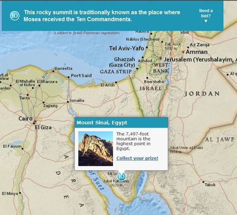
Although these were designed specifically for GIS day during Geography Awareness Week, these 2 excellent map-based treasure hunts from ESRI are great any time of year.  The answer to the question will only pop up in you are zoomed in the the right region (SHIFT + Make a box = Zoom to area).  These links will take you to the World Cities quiz and also to the Mountains quiz.

Seth Dixon's insight:

I love this geography, map-based quiz that let's people explore the world as they learn about some interesting places.  

Mark Hathaway's curator insight, September 9, 2015 2:52 PM

I enjoyed this exercise, it was fun and creative.

Douglas Vance's curator insight, January 18, 2018 7:00 PM

This is a brand new and to me, a unique way of exploring global geography by using trivia questions as a means to explore the world.

Kami Romeike's curator insight, April 8, 2018 5:29 PM

I love this geography, map-based quiz that let's people explore the world as they learn about some interesting places.  

Scooped by Seth Dixon
Scoop.it!

Social Media in Education

This is a primer on how to use online resources for geography students so they can learn more about the world by participating in global conversations (not just hearing about them).
No comment yet.
Scooped by Seth Dixon
Scoop.it!

Stories Displayed on Maps

Stories Displayed on Maps | Cultural Geography | Scoop.it
On myHistro you can create advanced geolocated timelines that you can play as presentations. Pin your events, videos and photos to the map and share them with friends and family.


This new resource, myHistro, combines interactive maps with timelines to organize stories, journeys or historical events as the move over time and place.  By embedding photos, videos and links this creates an incredibly dynamic platform for telling historical and geographic stories.  By combining these features, this is a powerful tool to create customized resources for you students.  Pictured above is a sample timeline that shows the spatial and temporal journey of the Olympic torch for the 2012 Games.   

benjamin costello's curator insight, May 20, 2015 5:38 PM

Interesting concept but not totally fleshed out for use by historians... genealogists perhaps would have a better or easier time using this program. It is very interesting but it only allows for one movement, so rather than showing the history of a nation you can show the history of a family through its interactive timelines. Google maps is not always accurate as well. 

Scooped by Seth Dixon
Scoop.it!

Stratocam: Google Earth Imagery

Stratocam: Google Earth Imagery | Cultural Geography | Scoop.it

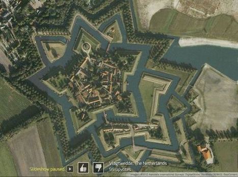
Much like sites that you can rate items up or down, you can rate the best aerial photography via Google Earth screen shots. There are some beautiful images and places to be discovered through this site. The physical and human landscapes are both intermingled in this fantastic collection of images…be careful, it can be amazingly addictive.   One this blog post I've added 13 of my favorite cultural and physical landscapes on to http://www.stratocam.com 

No comment yet.
Scooped by Seth Dixon
Scoop.it!

Historypin

This is a video introduction to www.historypin.com which might just prove to be a very useful and important project.  It's historical geography powered by collaborative mapping that is infused with social media dynamics.  Backed by Google, they are geo-tagging old photos to recreate the historical geographies of all places and comparing them with current street view images.  You can search by topic, place or date...this has the potential to be very big.   

No comment yet.