New nations seem to pop up with alarming regularity. At the start of the 20th century, there were only a few dozen independent sovereign states on the planet; today, there are nearly 200!
Research and publish the best content.
Get Started for FREE
Sign up with Facebook Sign up with X
I don't have a Facebook or a X account
Already have an account: Login

Almost "everything" about new approaches in Education
Curated by
Rui Guimarães Lima
 Your new post is loading... Your new post is loading...
 Your new post is loading... Your new post is loading...

olsen jay nelson's comment,
August 16, 2012 7:46 AM
This is just what I've been looking for, believe it or not:-)

Paul Rymsza's comment,
August 22, 2012 2:15 PM
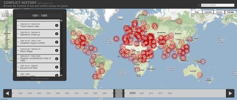
the potential of this site is amazing between the interactive learning system and the correlation between the timeline and location. If the human geography class is anything like this i can't wait for it!
|
benjamin costello's curator insight,
May 20, 2015 5:38 PM
Interesting concept but not totally fleshed out for use by historians... genealogists perhaps would have a better or easier time using this program. It is very interesting but it only allows for one movement, so rather than showing the history of a nation you can show the history of a family through its interactive timelines. Google maps is not always accurate as well. |


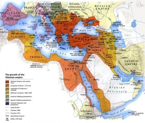
Amazing to see many of the countries and empires that are no longer around. Also with the dissoution of many of the empires it lead's to many of the issues that were are dealiing with today. Splitting the Austro-Hugaraian Empire after WWI along ethnic lines didn't really work and helped to lead to WWII. The Germans in the Sudetenland in Czechoslovakia fro example. See http://en.wikipedia.org/wiki/File:Sudetendeutsche_gebiete.svg
for the area of German population.
10 countries that have become nonexistent in the 20th century include Tibet, East Germany and Yugoslavia. These countries have died off because of ethic, religious and cultural falls that were quickly taken over by bigger and more powerful countries.
Essentially this article boils down to the issues of religion, ethnicity and nationalism. People who are diverse and have different ideas generally cannot all live together under one rule and agree on everything, hence nations split and new ones form to cater to their own beliefs and similarities.