Eclectic Technology
224.6K views | +3 today
Follow
Eclectic Technology
Tech tools that assist all students to be independent learners & teachers to become better teachers
Curated by Beth Dichter
Your new post is loading...
Scooped by Beth Dichter
Scoop.it!

Nature's Engineers – Google Green

Nature's Engineers – Google Green | Eclectic Technology | Scoop.it

"This Earth Day, we’re celebrating something close to our hearts, engineers. Whether it’s a towering aspen or a tiny mushroom, nature has plenty to teach us. We're taking a look at six of our favorite outdoor innovators to see how we can follow their lead and treat the earth better."

Beth Dichter's insight:

For Earth Day this year Google has created a website "looking at some of our favorite engineers from nature to see how they can teach us to treat the environment better...see the beauty and ingenuity of the natural world through photos from National Geographic. We also want to provide easy ways to be greener in our own lives, so this site shows us how we can all be like those organisms by taking simple actions to care for the environment." (This quote is from Google's official blog.)

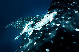
The images are amazing and you can "visit" two sites, South Africa, home of the "smart eaters", more commonly referred to as elephants and the Great Barrier Reef, home to the "ride sharers", also known as remora fish.

No comment yet.
Scooped by Beth Dichter
Scoop.it!

MapMaker Interactive - Explore the World with Interactive Maps

MapMaker Interactive - Explore the World with Interactive Maps | Eclectic Technology | Scoop.it

National Geographic Education beta has a new tool, MapMaker Interactive, that allows you to explore your world with maps. Select the region you want to map. There are options for themes, data and tools that allow for customization. Themes include Physical Systems: Water, Land and Climate; Human Systems: Population & Culture and Political and Economic; and Environment and Society. There are drawing tools and markers and you may download maps that you create. There is also a version that is black and white that has basic map elements as well as borders and names and other features. These maps may be printed out. The link to this is http://education.nationalgeographic.com/education/mapping/outline-map/?map=USA&ar_a=1. 

Lindsay Hoyt's curator insight, June 26, 2017 11:31 PM

Great tool for World History and U.S. History classrooms.