IELTS, ESP, EAP and CALL
18.5K views | +0 today
Follow
IELTS, ESP, EAP and CALL
Interesting links and articles related to IELTS, ESP, EAP and E-learning.  Available to teach ESP, EAP, Research Skills, IELTS, TOEFL and General English.
Curated by Dot MacKenzie
Your new post is loading...
Scooped by Dot MacKenzie
Scoop.it!

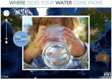
Where Does Your Water Come From?

Where Does Your Water Come From? | IELTS, ESP, EAP and CALL | Scoop.it

This interactive map documents where 443 million people around the world get there water (although the United States data is by far the most extensive).  Most people can't answer this question.  A recent poll by The Nature Conservancy discoverd that 77% of Americans (not on private well water) don't know where their water comes from, they just drink it.  This link has videos, infographics and suggestions to promote cleaner water.  This is also a fabulous example of an embedded map using ArcGIS Online to share geospatial data with a wider audience.  


Tags: GIS, water, fluvial, environment, ESRI, pollution, development, consumption, resources, mapping, environment depend, cartography, geospatial. 

No comment yet.
Scooped by Dot MacKenzie
Scoop.it!

Online Maps: 50+ Tools and Resources

Online Maps: 50+ Tools and Resources | IELTS, ESP, EAP and CALL | Scoop.it

"Mapping is a huge and growing sector, from social maps for sharing with friends, to mashing up Google Maps in every possible way."


You know that the technology exists for you to link your online information with maps...but not sure how to go about it?  This link from mashable.com lists over 50 sites that specialize is visually representing your data, information or projects.  Online mapping is not just for the experts, but being democratized ...online mapping for the masses! 

No comment yet.
Scooped by Dot MacKenzie
Scoop.it!

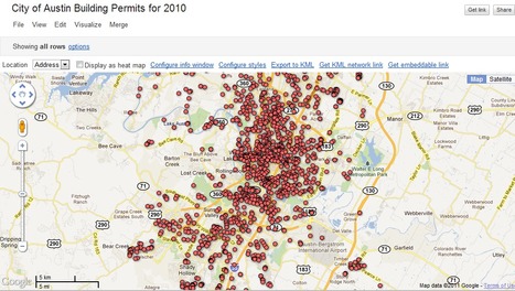
GeoChalkboard: Bringing Data to Life with Google Fusion Tables

GeoChalkboard: Bringing Data to Life with Google Fusion Tables | IELTS, ESP, EAP and CALL | Scoop.it

"Google Fusion Tables is an excellent way to create and share visualizations of data in map, chart, and tabular formats. Today we’re starting a new series of blog posts designed to get you up to speed with using this fantastic platform. We’ll also be releasing a free e-learning course called Bringing Data to Life with Google Fusion Tables to all our newsletter subscribers."

No comment yet.
Scooped by Dot MacKenzie
Scoop.it!

GIS - National Geographic Education

GIS  - National Geographic Education | IELTS, ESP, EAP and CALL | Scoop.it
Encyclopedic entry. A geographic information system (GIS) is a computer system for capturing, storing, checking, and displaying data related to positions on Earth’s surface. GIS can show many different kinds of data on one map.


This informative webpage (and accompanying features) simply answer the question, "What is GIS and how is it a useful way to work with spatial data?" 

Pau T.'s curator insight, November 2, 2014 5:39 PM

Què és un sistema d'infromació geogràfica (SIG/GIS)?

Scooped by Dot MacKenzie
Scoop.it!

World Bank eAtlas of Global Development

"The World Bank eAtlas of Global Development maps and graphs more than 175 thematically organized indicators for over 200 countries, letting you visualize and compare progress on the most important development challenges facing our world. Most indicators cover several decades, so you can see, for example, how 'life expectancy at birth' has improved from 1960 up through the latest year."  This tool should greatly enhance student projects as they will add more data, and see bigger patterns.  To go to the link visit: http://www.app.collinsindicate.com/worldbankatlas-global/en

No comment yet.
Scooped by Dot MacKenzie
Scoop.it!

MapMaker-National Geographic Education

MapMaker-National Geographic Education | IELTS, ESP, EAP and CALL | Scoop.it
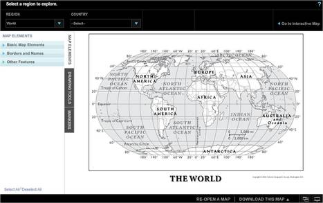
Customize one-page maps and download, email, print, or share!


Want to make a custom map don't have a cartographic background or access to GIS software?  This online program will give you what you need. 

No comment yet.
Scooped by Dot MacKenzie
Scoop.it!

MapMaker Interactive - National Geographic Education

MapMaker Interactive - National Geographic Education | IELTS, ESP, EAP and CALL | Scoop.it
Use our tools to explore the world, learn about human and physical patterns, and make your own maps.


This is an excellent online resource to allow student to create thematic maps without GIS software.  

No comment yet.
Scooped by Dot MacKenzie
Scoop.it!

Historypin

This is a video introduction to www.historypin.com which might just prove to be a very useful and important project.  It's historical geography powered by collaborative mapping that is infused with social media dynamics.  Backed by Google, they are geo-tagging old photos to recreate the historical geographies of all places and comparing them with current street view images.  You can search by topic, place or date...this has the potential to be very big.   

No comment yet.
Scooped by Dot MacKenzie
Scoop.it!

The Prime Meridian: Natural or Cultural?

The Prime Meridian: Natural or Cultural? | IELTS, ESP, EAP and CALL | Scoop.it
No comment yet.
Scooped by Dot MacKenzie
Scoop.it!

Earth As Art : Pick Your Favorites!

Earth As Art : Pick Your Favorites! | IELTS, ESP, EAP and CALL | Scoop.it

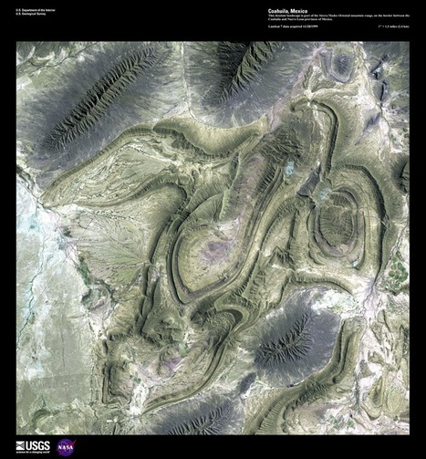
The USGS is celebrating 40 years of the LANDSAT

Program by having a competition to select the top 5 "Earth as Art" images from the more than 120 scenes from their curated collection.  All readers can select 5 images on the USGS website and the poll closes on July 6, 2012 (The image above is from Coahuila, Mexico).

No comment yet.