IELTS, ESP, EAP and CALL
18.5K views | +0 today
Follow
IELTS, ESP, EAP and CALL
Interesting links and articles related to IELTS, ESP, EAP and E-learning.  Available to teach ESP, EAP, Research Skills, IELTS, TOEFL and General English.
Curated by Dot MacKenzie
Your new post is loading...
Scooped by Dot MacKenzie
Scoop.it!

Geo-Literacy

Geo-Literacy | IELTS, ESP, EAP and CALL | Scoop.it

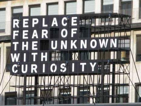
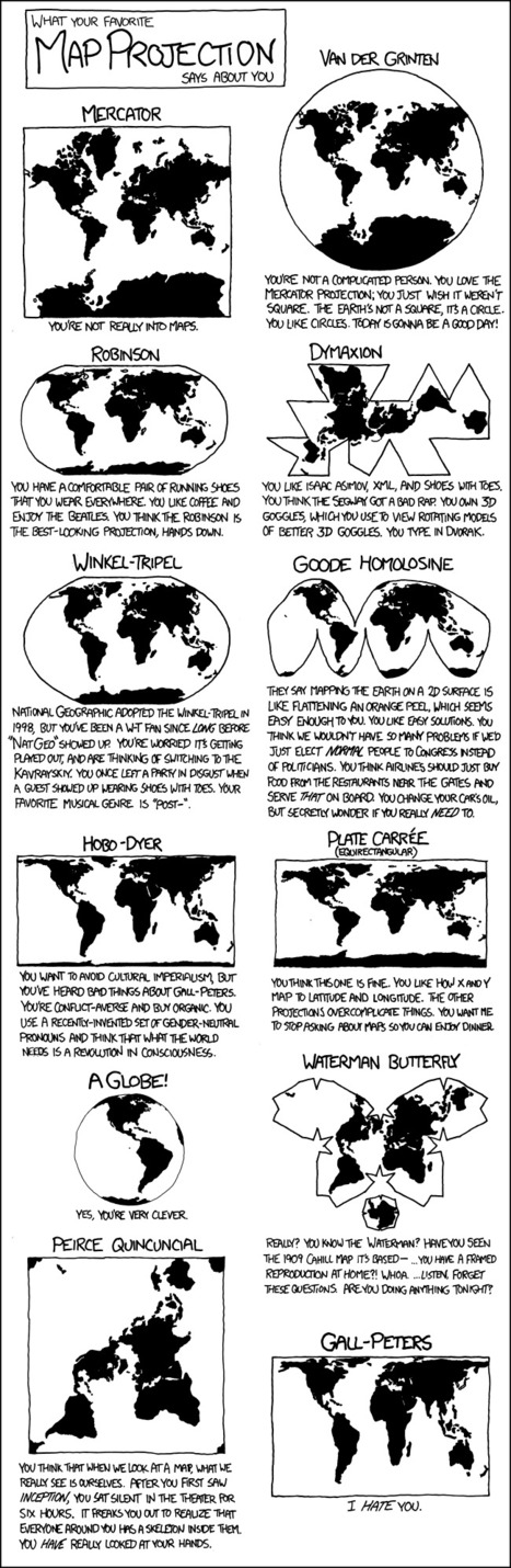
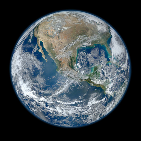
The Rhode Island Geography Education Alliance seeks to promote geo-literacy here in the Ocean State.  So what is geo-literacy? The National Geographic Society’s Educational team...


As the Alliance Coordinator for the state of Rhode Island, I organized  these three videos (two from National Geographic) and some pictures to provide a basis for understanding what geo-literacy is and why it is important for society and within the workforce.  In the spirit of sharing, I thought I'd share these links beyond the borders of Rhode Island. 


Tags: GeographyEducation, NationalGeographic, geo-inspiration, RhodeIsland.

No comment yet.
Scooped by Dot MacKenzie
Scoop.it!

xkcd: Map Projections

xkcd: Map Projections | IELTS, ESP, EAP and CALL | Scoop.it

Geo-geek humor -- A cartoon strip on the projector in the 3 minutes before class can be a good thing.  I'm a Robinson. 

Emily Bian's curator insight, September 28, 2014 8:36 PM

This cartoon strip shows the different types of map projections, and has a caption of what your personality is like if you like the map projection.

I thought this was really funny, especially the caption for the Peters Projection. I'm a Robinson for sure, because I just like the way it looks. I think all the different types of maps are good and useful in their own way, even the Peters... I guess...

We also learned all the different types of map projections in class, which helped me recognize these maps. This is also a humorous way for people who don't know the different map projections to learn it while still having a fun and good time. Maps are an important element in APHUG, because everyone should know how to read maps. It's part of Unit 1, because it shows the landmasses, and some maps can show different perspectives on things.

This quirky and humorous map will help the students in next year's APHUG class the different map projections, while having fun and finding out their personality that goes along with the different maps.

1) key geographical skills

Elle Reagan's curator insight, September 28, 2014 11:37 PM

This is a good overview of some different types of map projections and it has some humor too! I like how all the different types of map are all in one place. Also, each picture  is fairly detailed so that I can really see how one map is different from the next. I'm hoping this will be a good study tool in studying for the AP exam if there are any questions about different types of map projections.

Scooped by Dot MacKenzie
Scoop.it!

Geography is Key

This video is a class introduction to the Advanced Placement course in Human Geography, which is intended to give high-ability students the opportunity to ea...


This is an excellent promotional video for geography as a whole, but the AP Human Geography course specifically.  For more from this great Florida teacher, visit his course website which has some incredible resources. 

No comment yet.
Scooped by Dot MacKenzie
Scoop.it!

Geography students hold the key to the world's problems

Geography students hold the key to the world's problems | IELTS, ESP, EAP and CALL | Scoop.it
Geography may have slipped out of the top 10 A-level subjects, but that doesn't change the fact that work done by geographers has global importance, says Michael Palin...


Always good to remind ourselves why we teach geography and to remind them why it's important. 

No comment yet.
Scooped by Dot MacKenzie
Scoop.it!

"The Most Amazing High Definition Image of Earth Ever," Says NASA

"The Most Amazing High Definition Image of Earth Ever," Says NASA | IELTS, ESP, EAP and CALL | Scoop.it
NASA has released a new Blue Marble image, showing the United States of America. According to them, it's the "most amazing, highest resolution image of Earth ever." Blue Marble 2012 bests the 2010 edition and the original one.


Beautiful image...follow the link for a video of the image at a variety of scales as well as the specs and production that went into it.   There is an 8000 x 8000 pixel version as well as many lower resolution versions. 


No comment yet.