IELTS, ESP, EAP and CALL
18.5K views | +0 today
Follow
IELTS, ESP, EAP and CALL
Interesting links and articles related to IELTS, ESP, EAP and E-learning.  Available to teach ESP, EAP, Research Skills, IELTS, TOEFL and General English.
Curated by Dot MacKenzie
Your new post is loading...
Scooped by Dot MacKenzie
Scoop.it!

Selecting a Map Projection

Selecting a Map Projection | IELTS, ESP, EAP and CALL | Scoop.it
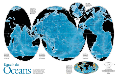
Video. Cartographers at National Geographic discuss how they select an appropriate map projection for the September 2012 magazine map supplement.


There is no one perfect map projection that fits all circumstances and situations. Think a situation in which this map projection would be an ideal way to represent the Earth and another situation where it is an incredibly limited perspective. 


Tags: cartography, K12, geospatial, NationalGeographic, water. 

No comment yet.
Rescooped by Dot MacKenzie from Remote Sensing News
Scoop.it!

Using satellite images, young students learn about human impact on environment

Using satellite images, young students learn about human impact on environment | IELTS, ESP, EAP and CALL | Scoop.it

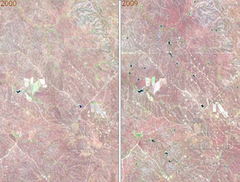
With the help of satellite images fifth and sixth grade students at Mr. Tim Blum’s geography class at the University of Wyoming Lab School got a birds-eye view of how humans have impacted or modified their environments. Images acquired by satellites decades apart showed cleared forests, irrigated crop fields in the middle of the deserts, altered landscapes (new roads and water bodies), and urban growth.


SD: Geospatial technologies can sound daunting for teachers that don't feel that they are specialists. Yet there are simple ways to make sophisticated technologies very relevant to just about any grade level as this article demonstrates. 


Via Elpidio I F Filho
joachim jake layes's curator insight, February 10, 2014 9:44 AM

great to see 5th & 6th graders learning about environmental impact

Scooped by Dot MacKenzie
Scoop.it!

World Atlas with Geography Facts, Maps, Flags

World Atlas with Geography Facts, Maps, Flags | IELTS, ESP, EAP and CALL | Scoop.it
World Atlas is an educational resource for world maps, atlases, and in-depth geography information. Teachers and students: free maps of Europe, USA, Canada, Florida, Caribbean Islands and much more.


This World Atlas, in addition to have many maps at a variety of scales as is very common these days, has the added feature of embedding facts and other informative features based on your scale and regional context.  Students can explore this at their own pace to learn about what every region of the world that interests them the most.

No comment yet.